5G+ coastal edge
Low-latency shore stations coordinate ports, islands, research vessels and near-shore drones while China’s 5G-A applications continue to scale.
China's 5G-A (5G+) rollout is moving from city coverage to coastal intelligence.
5GYY is designing a water-land communications fabric: today's fast, reliable 5G+ edge meets tomorrow's 6G ambition for continuous sensing from the shoreline to the deep ocean.
A research and deployment vision — every animal-facing device follows welfare, environmental and regulatory review.
SIGNAL ARCHITECTURE · 水陆一体
China's 5G-A (5G+) network is the near-term foundation. 5GYY's long-range goal is a resilient 6G ocean layer that hands data from shore, to underwater relays, to drones, sensors and satellites.
Low-latency shore stations coordinate ports, islands, research vessels and near-shore drones while China’s 5G-A applications continue to scale.
A future target for acoustic, optical and radio links that keep a trusted signal path across the water column, including hard-to-reach deep-sea zones.
Common identity, time and data standards let land, air, surface and subsea nodes share a live picture of the ocean instead of isolated snapshots.
A PRACTICAL EVOLUTION
Build with what is available now, design for what the ocean needs next, and keep every layer interoperable.
Move from delayed surveys to responsive remote piloting, edge inference and safer intervention.
Fuse video, sonar, chemistry, motion and environmental signals into one explainable ocean model.
Choose the right physical layer for distance, clarity, power budget and marine conditions.
Keep missions visible as data moves between subsea nodes, surface vessels, shore and satellite.
Sign sensor data, protect sensitive habitats and make every alert traceable to a device and time.
Design for years of field life with adaptive duty cycles, local inference and harvested energy.
PLATFORM · DEEP EXPLORER X1
A 5G+ surface workflow today, designed to accept future 6G underwater links, autonomous missions and sensor-chip telemetry.
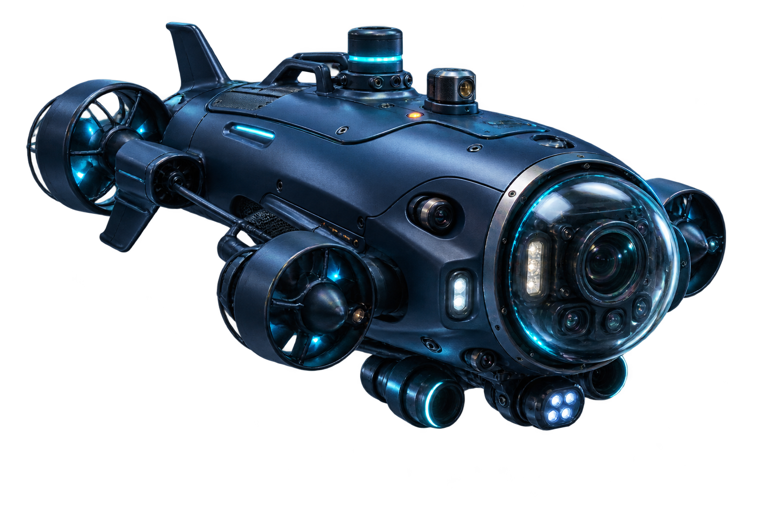
5GYY Deep Explorer · X1
An autonomous subsea node for marine research, offshore inspection and ecological stewardship. It surveys, relays and learns at the edge so critical signals do not wait for a vessel to return.
Surface 5G+, acoustic and optical links with a defined path to future 6G mesh nodes.
Video, sonar, water chemistry and motion data aligned to one timestamped mission record.
Local navigation and anomaly detection reduce bandwidth, risk and unnecessary disturbance.
Receive approved implantable or non-invasive tags on animals and underwater targets without losing provenance.
Adaptive sampling, hot-swappable packs and relay-aware routing extend time in the field.
PUBLIC REFERENCE · UNDERSEA SYSTEMS
Names that appear in open discussions of autonomous underwater vehicles, seabed payload concepts and submarine-launched systems — presented as context, not an operational guide.
This reference card places several well-known labels on one non-operational map: Poseidon as a nuclear-powered unmanned underwater vehicle concept; Seabed Warfare Upwards Falling Payloads (UFP) as a seabed-deployed payload concept; Trident II (D5) and China’s JL-2 as submarine-launched ballistic missile families; and VLS as the submarine vertical-launch architecture used to carry a launch vehicle.
公开资料注记:这些术语涉及军民两用与战略安全语境。5GYY 页面仅用于概念识别、历史语境与海洋通信研究,不提供制导、部署、制造或攻击建议。
OBSERVE · PROTECT · RESPOND
A persistent signal makes the invisible legible — without asking people to enter dangerous, remote or protected waters.
Fuse coastal 5G+ stations, pressure sensors and current models to refine local tide windows for ports, rescue and coastal communities.
Use welfare-reviewed implantable or non-invasive communication tags to understand movement, migration and habitat stress with less capture time.
Maintain a steady picture of marine protected areas, reef health and human activity in zones that are difficult to patrol.
Track seafloor temperature, chemistry, gas and micro-seismic changes to improve early anomaly detection around active volcanic systems.
Link pressure, wave and seismic observations into a low-latency alert chain for scientists, authorities and coastal communities.
Give rescue teams and researchers a live view before they deploy — and keep remote missions accountable after they leave.
OCEAN INTELLIGENCE LOOP
Every observation becomes more useful when it is timestamped, trusted and returned to the people who protect the coast.
Devices listen for tide, temperature, current, chemistry, movement and pressure.
Powered island and subsea relays move the smallest useful signal, not a warehouse of raw data.
Edge AI flags changes while scientists retain the full provenance and uncertainty.
Alerts, protected-zone rules and mission plans turn observation into a safer response.
POWER THE SIGNAL
Keep the network alive where a cable or battery swap is impractical: combine coastal infrastructure with renewable, low-power field nodes.
Powered relay stations sit near coastal islands and landing points to anchor the water-land backhaul.
Surface platforms harvest sunlight, buffer energy and forward a clean signal to nearby nodes.
Slow ocean currents turn compact generators to extend service windows without fuel runs.
Temperature-gradient materials contribute a low-voltage trickle that supports sleep-mode sensing.
REFERENCE TARGETS
A north-star specification for experiments, pilots and future 6G standards work — not a promise that every capability is commercial today.
Tell us which coast, habitat or hard-to-reach zone you want to understand better, and we will map the first safe signal path.
Open the signal wall